-40%
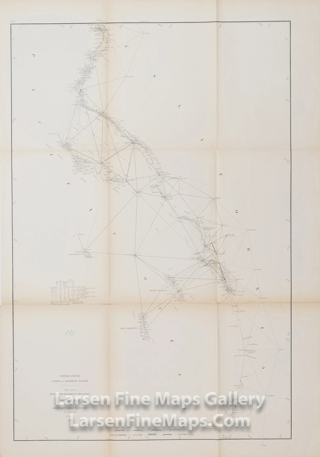
USC&GS Map California San Diego, Santa Barbara, Los Angeles, Pt. Conception 1879
$ 27.97
- Description
- Size Guide
Description
USC&GS Map California San Diego, Santa Barbara, Los Angeles, Pt. Conception 1879A very nice map showing the progress of the triangulation and survey along the California coast from San Diego to Point Sal, including all of the islands and a few inland triangulation stations. The coastline is highly detailed with many place names and some rivers shown. This is the lower sheet of the set. IMPORTANT NOTE: All of our United States Coast Survey (USCS), United States Coast & Geodetic Survey (USC&GS), and similar maps and charts have been professionally unfolded and flattened using humidity baths, semi-permeable membrane, and drying blotter techniques. Most others you typically see on eBay have not been, and worse, are quickly and crudely unfolded for the low-quality photos you see. Unfolding these maps in that way is damaging and weakens them. Please be aware. NOTE: eBay Buyer's Premium only charged on eBay.
USC&GS Map California San Diego, Santa Barbara, Los Angeles, Pt. Conception 1879
YEAR PUBLISHED:
1879
CARTOGRAPHER/MAPMAKER:
U.S. Coast and Geodetic Survey
PUBLICATION:
Report of the Superintendent of the U.S. Coast and Geodetic Survey, Showing the Progress of the Work During the Fiscal Year Ending with June, 1879
PUBLISHER:
Washington Government Printing Office, 1881
FULL TITLE:
United States Coast and Geodetic Survey, Sketch Showing the Progress of the Survey in Section No. X (Lower Sheet) From San Diego to Pt. Sal From 1850 to 1879
CONDITION:
Very good, overall toning, darker edges at folds, cropped margin and folded as issued, minor fold separations with some archival tape reinforcement/repair, see photos for details.
DIMENSIONS:
22.5 X 32.5
DESCRIPTION:
A very nice map showing the progress of the triangulation and survey along the California coast from San Diego to Point Sal, including all of the islands and a few inland triangulation stations. The coastline is highly detailed with many place names and some rivers shown. This is the lower sheet of the set.
IMPORTANT NOTE:
All of our United States Coast Survey (USCS), United States Coast & Geodetic Survey (USC&GS), and similar maps and charts have been professionally unfolded and flattened using humidity baths, semi-permeable membrane, and drying blotter techniques. Most others you typically see on eBay have not been, and worse, are quickly and crudely unfolded for the low-quality photos you see. Unfolding these maps in that way is damaging and weakens them. Please be aware.
NOTE: eBay Buyer's Premium only charged on eBay.
×
Buy now and save!
Tell a friend
Visit store
Watch now
Postage info
Click the Postage tab above the listing description for more info
FREE Postage
Click the Postage tab above the listing description for more info!
Additional delivery notes
PICK UP OPTION
Sorry, our items are NOT available for pick-up.
PAYING VIA PAYPAL
We accept PayPal on our all our items so you can shop with confidence.
Simple choose the PayPal option when proceeding through the checkout.
Additional Information
No additional information at this time
Ask seller a question
Contact
To contact our Customer Service Team, simply click the button here and our Customer Service team will be happy to assist.
Ask seller a question
© Larsen Fine Maps Gallery
Postage
Shipping is FREE for this item
Payment
Accepted Payment Methods
PayPal
Returns
Returns are
not
accepted
Buyer will pay for return shipping.
eBay integration
by


